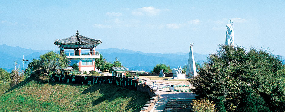
Typhoon Observatory
Safe Tourism and Experiences
Typhoon Observatory
Address
Hoengsan-ri, Jung-myeon,Yeoncheon-gun, Gyeonggi-do
Telephone
Tourism Division, Yeoncheon-gun Office +82-31-839- 2063Precautions
- For Entry: Show your ID card after entering the civilian access control post
(groups of more than 25 must submit an application at least 7 days in advance) - Hours: 9:00 a.m.-4:00 p.m. (closed every Tuesday) cautionUnexpected control may be enforced due to the circumstances of the relevant military unit.
Built on December 3, 1991 by the invincible Typhoon Unit, the Typhoon Observatory is located at the highest Suribong Peak of Biggisan Mountain in Jung-myeon, about 65 kilometers from Seoul and 140 kilometers from Pyongyang. At first, the northern and southern limit lines were set up 2 kilometers from the Military Demarcation Line, but as North Korea installed barbed-wire fences near the border in 1968, South Korea also partially installed them in 1978. On a visible day, visitors can see North Koreans working in the fields without a telescope.
The Typhoon Observatory is located 800 meters from the Military Demarcation Line (MDL) and 1,600 meters from the North Korean guard post. It is famous for being the closest observatory to North Korea along the MDL that stretches over 155 miles. At the Typhoon Observatory, there is a church, catholic church, statue of the Virgin Mary, Buddhist sanctum, and a bell tower where South Korean soldiers can hold religious gatherings, as well as a monument for the displaced Koreans who had left their homes in the North, monument for the Korean War, and monument for boy tank drivers who participated in the Korean War. The exhibition hall displays daily necessities and commodities from North Korea recovered from the Pilseunggyo Bridge on the Imjingang River, 2 kilometers from the observatory, and some infiltration equipment used by armed spies who infiltrated the area dozens of times since the armistice.